Pages

Showing posts with label Kanawha. Show all posts

Sunday, June 4, 2017

Salt Works: What's Old is New Again

One of the earliest industries in West Virginia was nearly forgotten about until recently, when the J. Q. Dickinson Salt Works revived the salt-making business that had been in their family since the very early 1800's. I've read several accounts of West Virginia salt history, and there are some conflicting facts and dates, so if you see a glaring error in this post, please comment below. 

Salt was a precious commodity in pioneer times, as it was needed to preserve meat. Most settlers found a salt lick (a spring where the water is salty) and boiled down their own supply, a process that could take days of labor and hundreds of gallons of water. Finding a lick was easy--simply follow the wildlife. Even today many roads in West Virginia and probably other Appalachian states are named things like Buffalo Lick, Stone Lick, Big Lick, etc.

I had heard about the re-opening of the Kanawha Valley salt works a few years ago, and we finally had an opportunity to visit. I had always heard this referred to as "salt mines" but in reality the salty water is brought to the surface with brine wells. Tobias Ruffner and his brother David drilled the first deep brine well in 1808 and found an underground reservoir (the ancient Iapetus Ocean) that produced more brine that anyone would have thought possible. Tobias was a true gadgeteer and homespun engineer, building most of his own tools as the need arose; he was the butt of many jokes until his determination paid off. His well is believed to be the first deep bored well in the United States. The Ruffners also were the first to use coal to fire their evaporators, instead of the traditional wood. Most of the forests in the area had been cut to feed the hungry salt industry, so coal was a good alternative and was abundant in the region. 

Thousands of people worked at the salt works and wells were drilled up and down the valley as more people got into the salt business. One of those was the Dickinson family, who operated wells first with rented equipment in the area of present-day Belle, but in 1814 moved to Malden to the area called the Kanawha Salines and drilled their first brine well in that area in 1817. There they became part of the trust known as the Kanawha Salt Company, which was a group of four salt producers who sought to regulate the quality and the price for salt, as prices began to plummet with so many wells in production. The legendary former slave Booker T. Washington worked in the salt works as a young child after slavery was abolished, and described the work as grueling and his life in early Malden as hard and primitive, scrabbling for survival. I am sure his experience was echoed by many of the people who worked in the industry. 

The saltworks continued in operation until the mid-70's, although the salt produced was not, I think, for home use. Rather it was in demand in the growing chemical industry in the Kanawha Valley. My husband remembers visiting a friend who had served in Vietnam with him who worked at the Malden works and lived in one of the cabins reserved for workers on the property. These cabins still stand, I understand, but they and some other sites of the original workings are now private property and off limits to visitors. The works eventually shut down until the descendants of the original Dickinson family decided to revive the business and create gourmet table and cooking salts. Now there are tours of the new works, a gift shop and monthly farm-to-table dinners, along with other activities offered to celebrate the revival of an old tradition.


I was fascinated by the whole process, and the history behind it. The early way of extracting brine was a dangerous, tricky enterprise. Large hollow trees were lowered into holes dug into the muddy licks, and men were lowered into these to send up buckets of the brine, according to our tour guide.
Men could only stay down in the wells a certain length of time before they had to be brought back to the surface; derricks similar to those of oil wells were used for these wells as well as the later ones.


This is one of the early well sites, I think the guide said. The large stone to the right was on top of the large gray stone structure. The one of the right is one solid piece. The company is not sure how exactly this well operated. I was just stunned at the size of that stone slab!


Today the brine is pumped from the wells with modern electric pumps, and stored in large tanks for a day or two to allow some of the sediment to settle. Then it is sent to the salt houses and the process begins. Solar power is used for evaporation instead of wood or coal, so it's a far more ecologically friendly process.

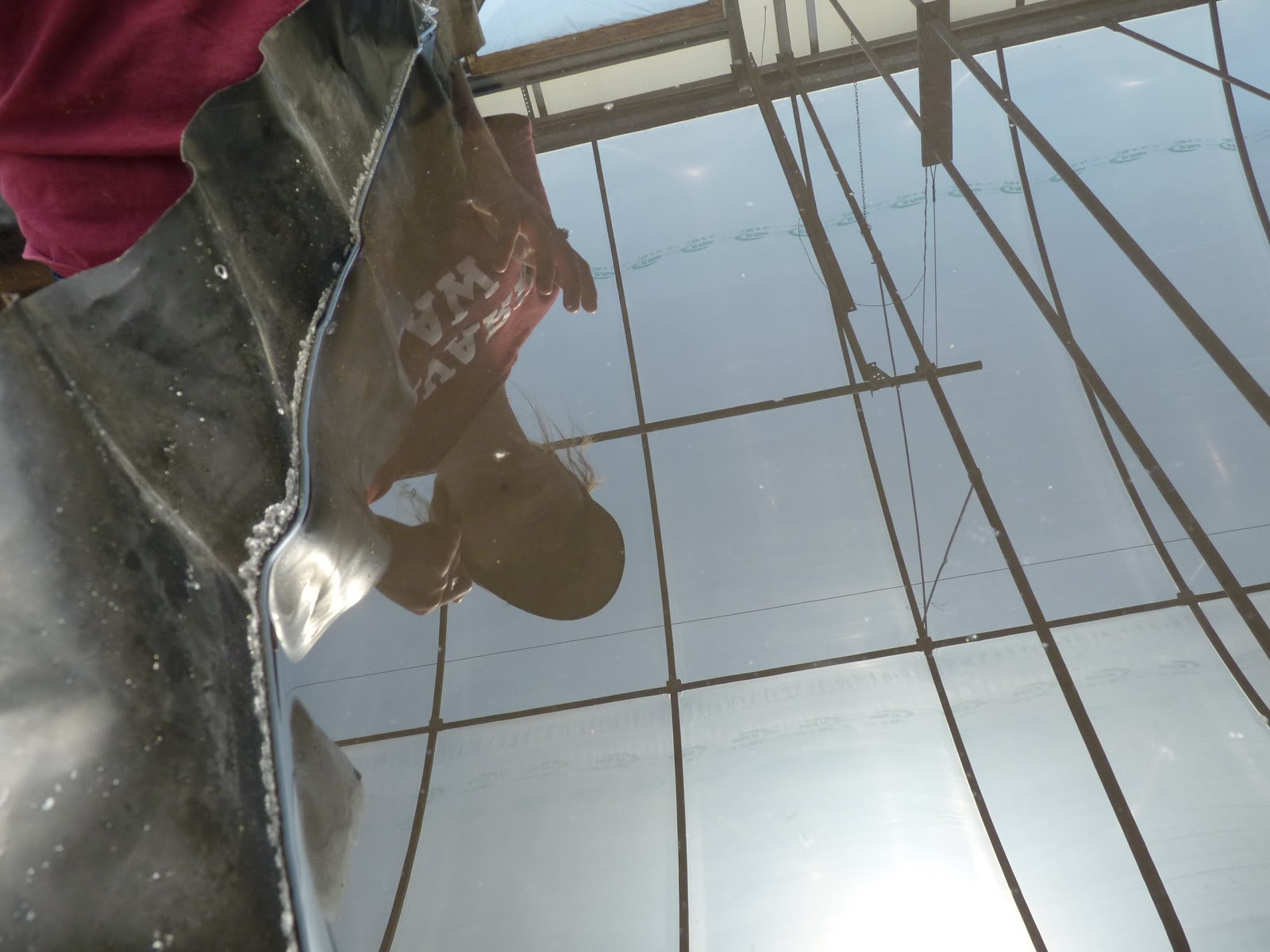
Here is the brine in one of the sunhouses, which resemble large greenhouses. In these houses the brine is allowed to evaporate and the calcium separates and sinks to the bottom of the trays.


It was pretty warm and steamy in here--my camera lens fogged immediately and I had to clean it often to take photos.


From the sunhouses the brine is transferred to another large tank, and finally to the last step of the process.
 Here, you can see the salt crystals forming. They are remarkably beautiful, very white and square! I thought they had settled to the bottom, but actually the crystals are floating on top. When they have been in these trays a day or so (I can't remember exactly what our guide said), they are raked up with the skimmer (the long-handled tool in the below photo), and then scooped up into buckets with the wood scoop.


The process is repeated 2 or 3 times for each tray, and the crystals get smaller each time.


You can see salt gathering bere on the sides of this new tray which had just been filled that morning.


The final step: The salt is sifted, cleaned by minute inspection, and put into flour-sack fabric bags.


Cleaning is done literally with a pair of tweezers! Each batch is carefully inspected and any minute fleck of dark matter is removed.


Finished, graded and ready to package.


In the gift shop, a model of the original works is displayed. This was made by a prison inmate who was taking a class that required a project based on history. He chose the salt works and did an excellent job.


Several different products are offered for sale in the gift shop. There is the table salt, available in grinders or bags, pioneer salt which is reddish-brown and is like the salt the early settler made. It is often purchased by historical groups and re-enactors, and has a strong iron flavor. There are also flavored salts offered in gift packs, and an incredible burnt caramel sauce that tastes better than any I have ever tasted.

We came home with a grinder and some caramel sauce. I wondered if there would really be a difference in the taste of the salt. I mean, salt is salt, right? I was startled by the clarity of the flavor--I can best describe it as clear and bright. We don't seem to use as much of it either. The grinder is refillable and refill salt can be ordered online.


We tasted the caramel sauce at the gift shop and I can't wait to get some good vanilla ice cream to go with it. Delicious!

If you'd like to visit the saltworks, tours are offered daily except for Sundays, when they are closed. Check out their website for more information or to order salt and other items.

And if you're interested in more history about salt-making in West Virginia, these are the resources I consulted for this post:

Dickinson Family. West Virginia Encyclopedia Online.

Fallows, James. Artisanal Salt from an Ancient Sea. Atlantic magazine, Dec 5, 2014.

History of the Great Kanawha Valley [West Virginia], Volume 1. Brant, Fuller & Co., pp 166. (Online at Amazon.com)

History of West Virginia Mineral Industries--Salt. WV Geological and Economic Survey.

Ruffner Family. West Virginia Encyclopedia Online and West Virginia Heritage Encyclopedia,
Volume 19, published by Jim Comstock, Richwood, WV 1976, pp 4175-4176.

Tobias Ruffner.West Virginia Heritage Encyclopedia, vol 19, pp 4176-4179.

Salt industry history. West Virginia Heritage Encyclopedia,vol 19,  pp 4210-4211.

Booker T. Washington and saltmaking. West Virginia Heritage Encyclopedia, vol. 19, pp 4181-4182.

Settle, Mary Lee. Addie: A Memoir. University of South Carolina Press, 1998.


Copyright Susanna Holstein. All rights reserved. No Republication or Redistribution Allowed without attribution to Susanna Holstein.

Tuesday, January 14, 2014

That Chemical Leak

Photo by Tyler Evert. www.tylerevert.com
It's been in the news everywhere, and it's not pretty. Hundreds of gallons of a toxic and potentially harmful chemical leaked into the water supply of thousands of people in the Elk River and Kanawha Valley regions of West Virginia, and what people have been going through can only be described as a nightmare--one with recurring themes and odd twists. We were not affected personally, but so many of the people we know have been, and it has been the most difficult of times for them.

I was stunned to read that the storage tanks responsible for this leak had not been inspected in over 20 years, and apparently that standard procedure for tanks storing such chemicals. In 20 years my youngest son started kindergarten, graduated from college and is well into his career. My second youngest son graduated from high school and college, married and had two children and is nearing the age where he could, if he wanted, retire. I had a twenty-year library career in those 20 years! And every one of us had regular health checkups, but these tanks? No one thought that they could be a problem. Really. You can read the newspaper article and interview with two Department of Environmental Protection employees here.

I have to admit to a guilty relief that I no longer work in the valley, and that I am no longer responsible for the safety and security of most of the libraries affected by the leak. Had I still been working, I'd have been on the phone, in meetings, following news, reassuring staff, making decisions and then when the all-clear was given, right there with my maintenance guys flushing the systems and getting everything back to rights. I get chill bumps thinking about what my life would have been like the past week, and I feel so sorry for the staff who are now coping with this emergency.

I think too about the impact of this leak on the daily lives of so many people I know. People who live in the valley, who drive to work there, who depend on tips and part-time work to make ends meet. These people are now trying to clean this mess out of their homes, out of pipes and filters and appliances and who knows what else. We seldom think about just how many places water travels in our houses: yard sprinkler systems, refrigerator icemakers, toilets, hot water heaters, hot water heat, outdoor faucets...and all have to be flushed and filters changed.

That's the immediate impact, but the longer term one may be more worrisome. Even if health officials say it's okay to bathe and make coffee and drink the water again, is it really? Would you trust it? How long before people experience the soothing relaxation of a steamy hot shower (and forget about the woman who was hospitalized for taking a nice hot shower last week?).  How long before they stop sniffing suspiciously at their coffee, or wash their hands without worry? How long before people stop monitoring their health and that of their children, pets and livestock to be sure there were no long-lasting effects of using the water before the leak was discovered and the Do Not Use order issued? How long before homebuyers forget that the homes in the valley were all contaminated at one time with this chemical? How long before people recover from the economic impact of this disaster on their paychecks? And what about the effect on their budgets, with having to buy all the water they were using during this time period?

So many questions remain. So many may not be answered for a long time. The one question that must be answered and answered soon, is "how will we prevent this from ever happening again to any community?" I'm waiting to hear the answer to that one.

I have been awed by the way people have managed to get through this. They have stepped up and helped each other, shared information and kept going despite the difficulty. They have vented, joked, worried, laughed and kept each other informed. Erin Brockovich, famous for her role in the movie Erin Brockovich that told the story of her fight against pollution by Pacific Gas and Light, has come to West Virginia to help in the investigation.

Having no electricity can be inconvenient, but having no water? That's a threat to life itself.


Copyright Susanna Holstein. All rights reserved. No Republication or Redistribution Allowed without attribution to Susanna Holstein.

Tuesday, September 3, 2013

Traveling into the Past

Copyright Susanna Holstein. All rights reserved. No Republication or Redistribution Allowed without attribution to Susanna Holstein.

We spent Labor Day tracking memories. Larry has been thinking about visiting the place he grew up and possibly finding the family cemetery. We decided to go last Wednesday but one thing and another got in the way. Finally, Monday was the day.

It had been 20 years since we last saw Olcott and the area around Brier Creek in Kanawha county, WV. We only live about 60 miles away but life has a way of rushing us along.

Many places he remembered are gone. This was the site of a one-room school his brother and older sister attended. Up this hollow was where his granny's cabin used to be, the one I describe in my story The Headless Woman of Brier Creek. The cabin and all traces of her home--outbuildings, well, foundation stones--have disappeared. Our prints on this earth are fleeting, aren't they?

This was the school Larry attended, Olcott Elementary. It is abandoned and the roof has caved in. Note the tall chimney--in coal country, this school used coal for heat.

Some of the letters of the school's name still remain. Larry attended school here for six years and I could almost hear his boyish shouts as he ran around the playground.


Many of the little side roads were pretty rough (we should have taken the truck).

This small church, Olcott Baptist, I believe it was, or possible Church of God, is still in active use.

The remains of the old powerhouse that provided power to the nearby mine,


and the remains of train tracks that once carried loads of coal out of the mines located up the hollows.As a teen, Larry had a rail buggy that had Chevy wheels. If he let about half the air out of the tires it would ride right on the rails very well. Once, however, when he was riding on this particular stretch of tracks, he got stuck in a place where a branch line connected to the main line. He could hear a train coming and flagged it down, The trains traveled very slowly and the engineer saw him, stopped, and pulled him out. Larry continued on his way in front of the train, honking his horn and waving to the neighbors as he passed by. What memories.

This used to be the home of the mine superintendent. I believe the mine was owned by the Black Band Coal Company, which was the one his father worked for. We have some scrip from that company.


This is Beetree Mountain, heading down. Larry tells several stories about this stretch of road. In one, a friend owned a late 50's convertible (I forget which make). As he headed down the mountain at a fairly good speed, he hit the brakes and found he had none. He thought quickly, and decided to put up the convertible top as a brake to slow the car. As you might guess, it didn't work. With a whoosh! the top was ripped right off the car. Fortunately the friend was able to stop and was unhurt. The same can't be said for the convertible top.

Another story he tells is about sledding on the hill. He and his friends would work for hours, hauling buckets of water up the hill and pouring it down to let it freeze on top of the packed snow, making an incredible sled run. Unfortunately for people in cars, the ice made it impossible to drive down the hill and many a man and woman walked home when the kids were sledding.


I have never, ever seen a stop sign for a train! This one says Stop and Dismount. I have no idea what that could mean. I know dismount means to get down off of something, but what can it refer to here? There is a branch line that comes into this track a little further up, also a road crossing and a trestle so I am sure it has something to do with one or all of these.

Along this lonely stretch of road, Larry recalls rows of company houses; now there is only green and quiet.


There once was a railroad roundhouse here, or nearby, as he recalls. We think

the bricks in this photo might be the only reminder of the roundhouse's existence.


Tomorrow--a visit to the family cemetery and with an elderly but not old cousin.

Monday, October 25, 2010

Down by the Riverside

I took these photos last week and have not had a chance to post them. We were at the state capitol building for a concert at the culture center, both of which are located near the banks of the Great Kanawha River in Charleston, WV. The night was beautiful, the building glowed and there were two sternwheelers on the river.

 The West Wing entrance to the capitol. This is the entrance to the governor's offices; the wide walk leads to his mansion which was just behind me as I took this photo.

The first sternwheeler cruised into view just as the last light of the day was fading on the horizon.

See the water splashing off the paddles on back of the boat?


In a few minutes, the second sternwheeler came up but I could not get a good photo of it. When I turned around there stood Lincoln, as somber as ever: the bronze sculpture called "Lincoln Walks at Midnight" captures the essence of what it must have been like to be president in the turbulent days of the Civil War.


Some evenings stay in our memory a long time. With digital cameras, we can retrieve those times in photos to savor again and again. Even if the photos aren't perfect, they make me happy and help me relive the soft breezes, clear air and the fun of walking at dusk with a friend along a beautiful river.

Sunday, August 16, 2009

Bridge and Bird

This bridge crosses the Great Kanawha River near Falls View, WV. I had to drive across, just to see what the river looked like from the bridge.


This is what I saw: green trees, wide rippling river, fog rising from the mountains after the recent shower.

Then I saw a bird--but what kind was it? It was too far away to tell, so...
I zoomed in when the bird landed (watching all the while behind me to make sure no cars were coming--this is a narrow bridge, and not much on the other side, so I felt comfortable about stopping and snapping)...


and saw where he (or she) had landed on a dead tree. Still I was not sure what this bird was.


but in the last zoomed picture, I think that it is an osprey, also known as the fish hawk. And it seems to have its wing spread to dry--or is that for balance?
The trip across the bridge was definitely worth it. I noted that on the other side, there is a road down to the water. Next trip on Route 60, I'm going down there to see what might be hidden on the shores of the river.


Monday, August 3, 2009

On the Way to Clifftop

The journey is often as interesting as the destination. On the way to Clifftop for the Appalachian String Band Festival, we saw:

This mother nursing her babies beside the bank drive-through. Maybe she needed milk money?

Boomer Bottom Road in Boomer, WV--and the next road to it is Lenten Lane. Repent, ye sinners! (Now you do know, don't you, that a "bottom" in West Virginia means a small flat field beside a creek or river? Clean up your minds out there!)


Much mining of coal and coal equipment, like the Mammoth mines coal tipple.


Beautiful water, since we were following, for most of our journey, along the banks of the Great Kanawha River (pronounced kun naw', in case you wondered).


Four lovely waterfalls, like this one known as Cathedral Falls along Route 60 near Gauley Bridge.


And one old storyteller trying to keep her balance on the rocks beside said waterfall.

There is a lot of history along Route 60, also known as the Midland Trail because it was the main route for early frontiersmen and settlers, and legend has it that the route was originally traced by buffalo and native Americans. I've touched only a small portion of it. Traveling the old roads so often brings rewards, and it's why we left early enough to accommodate our ingrained rubbernecking tendencies.

I learned this evening that what we are actually has a name: shunpikers. Who knew? I thought I just preferred backroads, but evidently there are a lot of people just like me who travel the old roads in search of the real life of our country.

Related Posts Plugin for WordPress, Blogger...